2014 Satellite Map of Turneffe including Marine Reserve Zones
2011 Maps showing various usages of Turneffe Atoll
2014 Mapping of Turneffe's Lobster Trapping Fishery
| |
2014 Satellite Photo of Turneffe Atoll
produced by Mike Beltz 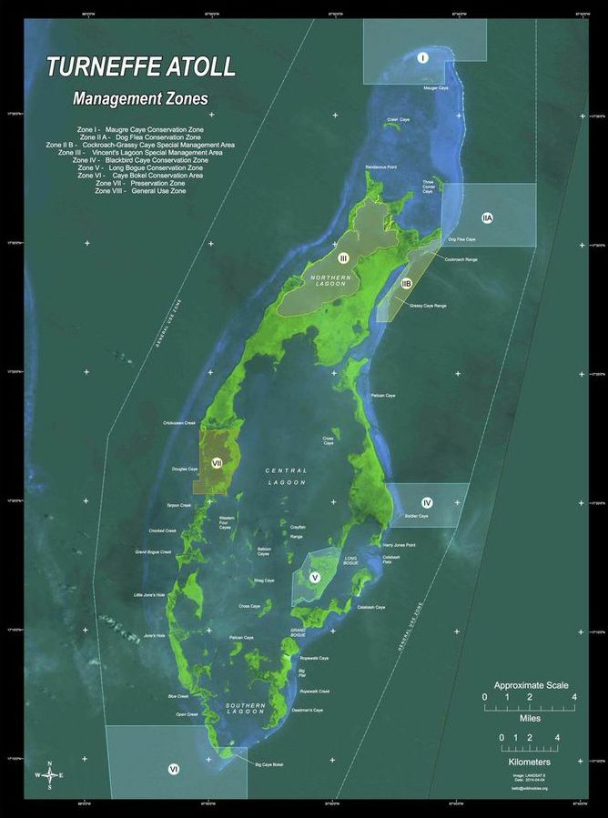 |
|
The following maps, produced by Turneffe Atoll Trust in 2011, display the various uses of Turneffe Atoll. They were developed through extensive consultation with pertinent parties including commercial fishermen, dive guides and long-term fishing guides.
In February, 2014, the World Wildlife Fund funded a detailed analysis of Turneffe's Lobster Trapping Fishery. This detailed analysis was done by Dale Fairweather and George Myvett and included all but one of Turneffe's fish camps. The Link below provides a detailed look at this fishery.

